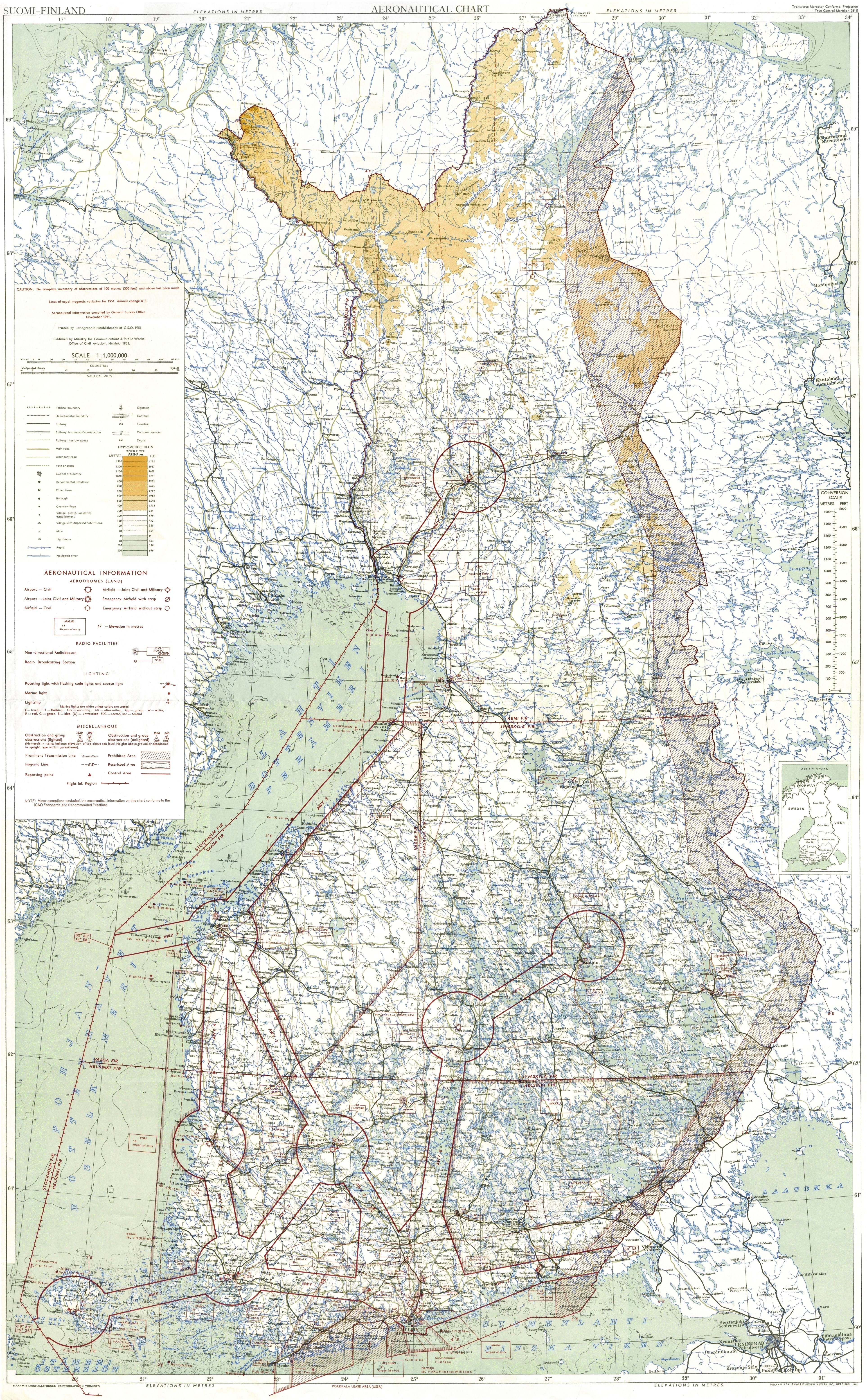
1. Aeronautical Chart for Suomi-Finland 1951 (below)
- It shows airways (AWY), airports (AD) and NDB radio beacons.
- Best equipped were:
AWY 3 (Rovaniemi-Helsinki, N-S) and
AWY 1 (Helsinki-Mariehamn-Sweden, E-W)
- N.B. Light beacons were still in use in Mariehamn and Ĺbo,Turku !
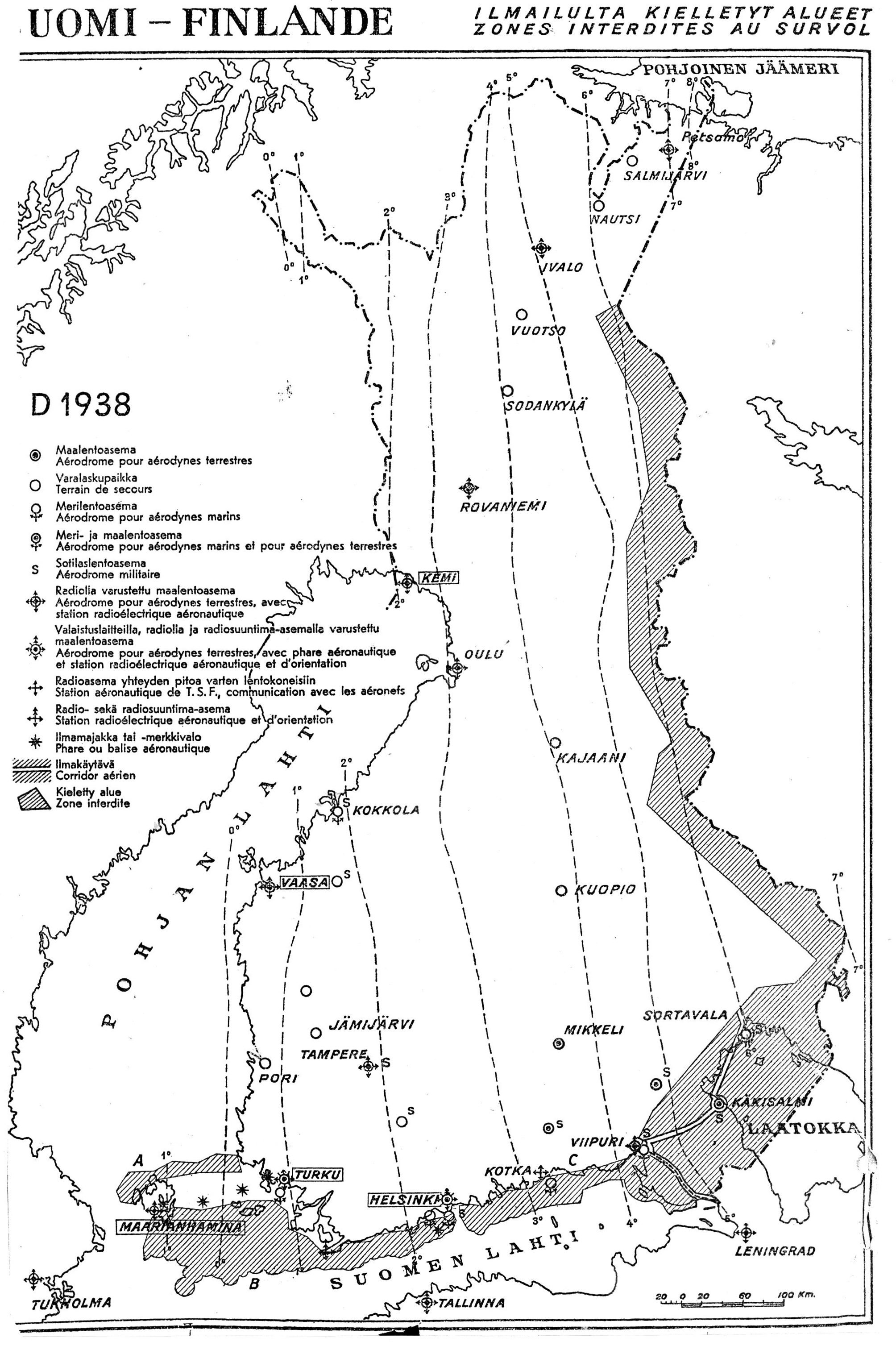
2. 3. 4. Overview maps (right) -
from year 1950?, 1948, 1938
- These maps display the development of aviation facilities in Finland. After WW2 one introduced airways with radio for communication and navigation. Radio equipment was mass-produced during the war, and became more affordable and less heavy.
Links. References.
• Utility Forum, History - about NDBs in Finland, visits to sites, emitter photos!
• Old maps - here maps 2. and 3.
One can select language for Google translate!
• Timo Meriluoto - Old Maps /
Timo Meriluodon Vanhat Kartat
Large collection of scanned old maps. In Finnish but Chrome Translate works well.
• Aviation maps / Ilmailukartat
- in 2015 four maps, here map 1. and 4.
N.B. I have resized map 1. with 50%.
Updated: 17 March 2015
Bo Justussson, Stockholm
Contact: justusXownit.nu
- replace X with @
- aerodromes, airways, radio stations,...
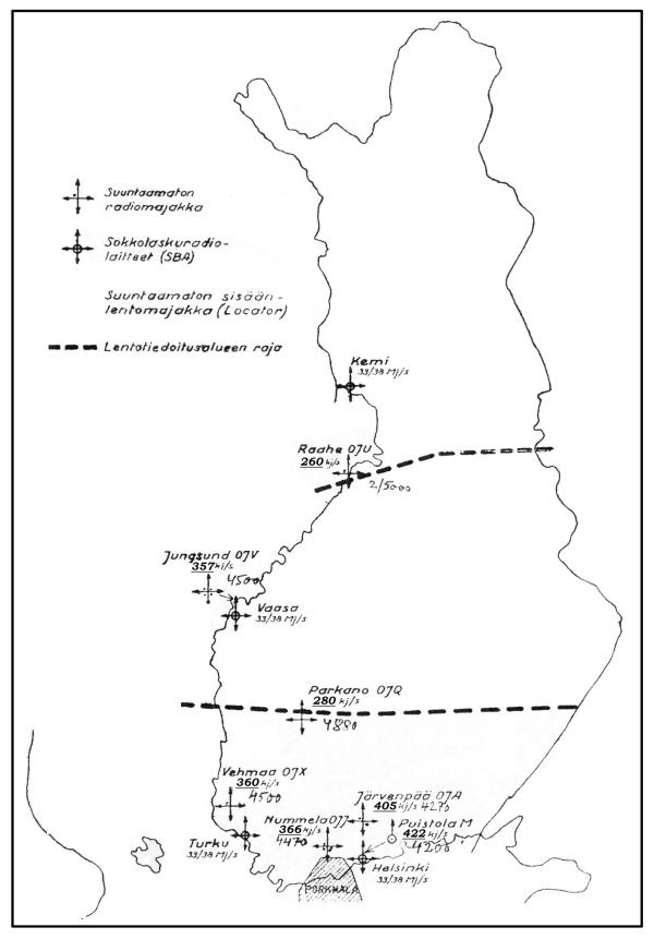
- this map corresponds closely to the large map 1. below.
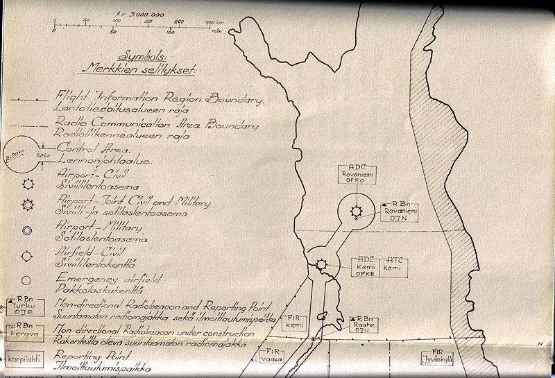
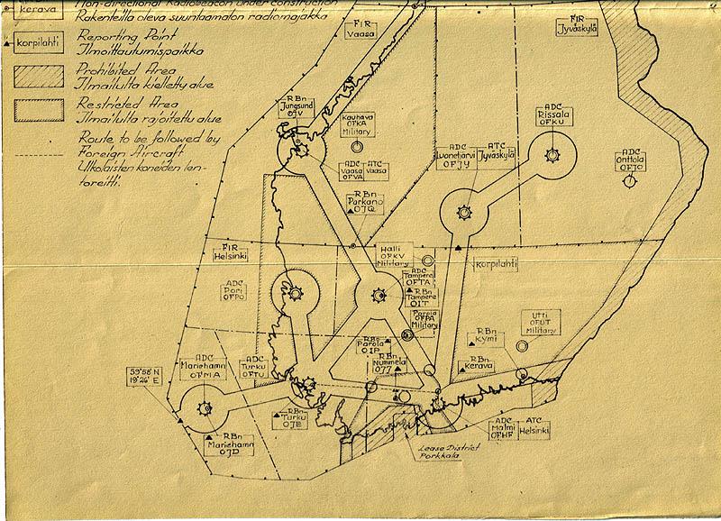
- NDB (radiomajakka) in Raahe, Jungsund, Parkano, Vehmaa, Nummela, Järvenpää, Puistola (Locator).
- SBA in Kemi, Vaasa, Turku, Helsinki
SBA = Standard Beam Approach, Lorenz radio landing system,
with direction beam, but not glide path beam, see • Lorenz, SBA
- 11 aerodromes with radio stations.
- Radio beacons in Turku, Hanko, Helsinki, Kotka.
- Light beacons in Mariehamn, Kumlinge, Iniö, Turku, Helsinki.
- Seaplane aerodromes: Kokkola, Mariehamn, Turku, Helsinki, Kotka, Viipuri.
Use Ctrl-'+' to enlarge! Map from A.