extreme
Central
The Central Line of Peru (Ferrocarril Central Andino) starts in Lima at the coast and goes steeply up into the Andes. It passes Oroya and ends in Huyancayo. It reaches 16 000 feet and has 21 zigzags. The line is in operation today. Highest point at Abra 4843 m and with the highest station Ticlio.
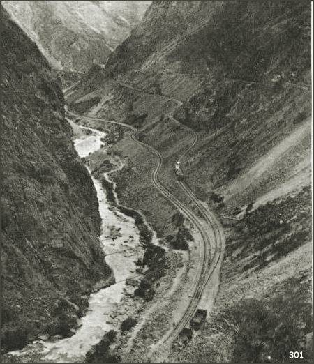
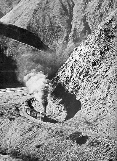
Zigzag in Rimac gorge on Central of Peru line.
A very good zigzag photo. It can be used at prototype for a small model railway, see my model pages.
Photo: unknown.
Source: Reproduced from M.Irlam's website, see below.
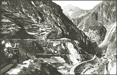
Zigzag at Cacray on Central of Peru line.
Photo: unknown.
Source: Reproduced from M.Irlam's website, see below.
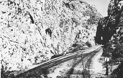
Double switches at a zigzag of Central of Peru line.
Photo: Roy Christian, Ken Mills, 1969-70.

Map over Peruvian Central line.
Full size map image, 1244x755 pixels
Map:
Michael J. Irlam's website:
- Mike's Railway History - The way it was in 1935 contains many pages with informative texts and old photos.
- Mike's: The Railways of the Andes has a good general text and 10 photos - two of them show zigzags and are reproduced above.
- Railroad Development Corporation - Ferrocarril Central Andino S.A. Webpage for the private company that since 1999 runs the Central of Peru line. With some recent photos.
- Sketch maps of railways of Peru in 1999 drawn by Stephen Phillips, Hereford, UK. Sketchy but detailed!
- Rinbad - Railway geography and infrastructure in Europe and around the world.
- Trackmap.net - Railway maps
Southern
The Southern Line of Peru (Ferrocarril zzz del Peru) From Arequipa up to Juliaca. A short line to Puno and Titicaca lake (with boat traffic?). Another line goes to Cusco and then onto Macchu Picchu.
in Equador
The line Ferrocarrill Guayaqil-Quito starts from almost sea level and ends in Quito at 3000 m (10 000 feet). The most famous part is Devil's nose (Nariz del Diablo) a steep cliff with a double zigzag and gradients up to 5.5 per cent. Today only tourist traffic exists and runs from Riobambe to Alusio and passes Nariz el Diablo and stops in Simbambe. Then it returns to Alusio.
Devil's nose. A train running backwards on an upper track, and the third level is seen further above.
Photo: Roy Christian, Ken Mills, 1969-70.
- Nariz del Diablo a travel report from 1999 with maps, photos and a delicious horizontal page layout.
- Guayaqil & Quito Railway, by Colin Churcher (1988, 1993) The photos from Devil's nose are very good.
The line from Salta in Argentine to Antofagusta Chile is called Tren a las nubes (Train to the clouds). It reaches 12 000 feet and was built in 1948. It has two zigzags and two loops. The line still runs as a tourist line until Socompa at the Chilean border. It is difficult but possible to continue with freight trains into Chile.
An expressive photo with a large steam engine in Argentine, close to Salta. Also showing the dry conditions in the inner parts of the Andes.
Photo: Roy Christian, Ken Mills, 1969-70.

Close-up large Argentine loco, a Henschel 2-10-2 .
Photo: Roy Christian, Ken Mills, 1969-70.
- Tren a las Nubes (many small photos, in Spanish). Part of a tourist website about Salta with lots of information: saltadelalma.hypermart.net.
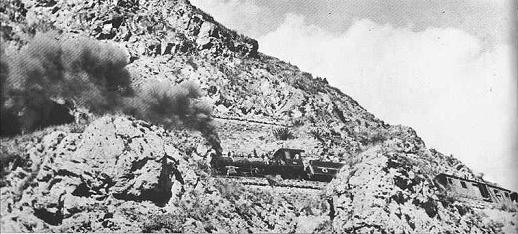
andino
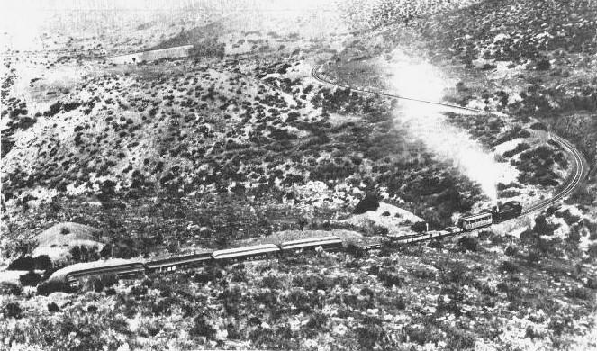
Photo: Archive photo, before electrification that was undertaken in 1927.
Source: Messerschmidt (p 89), see below.
References:
- Roy Christian and Ken Mills, South American Steam 1970.
Published privately. It contains 102 photos, mainly of steam engines. Some remarkably old 4-4-0 engines in typical American style are looking like coming directly out of cowboy movie. See photo below of a Rogers engine from 1871 that was still in use in 1969.
The authors published another book:
- The World of South American Steam in 1974. Similar titles but I think they are different.
- Wolfgang Messerschmidt (1972), Zahnradbahnen (Rack railways), Stuttgart: Franckh'sche Verlagshandlung, ISBN 3-440-03833-5. (208 pages, 152 photos, 96 drawings)
Today's railway services:
- The Rough Travel Guides for Argentine/ Equador/ Peru/ Chile have information on train services.
- Steam in the Americas 2002 has fresh information on steam trains in service.
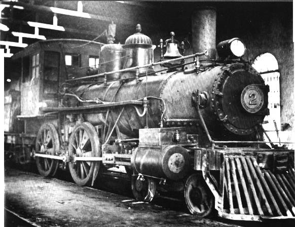
Below a Rogers engine from 1871. Still in use in 1969 at Tranporte Y Embarques Del Norte, Puerto Eten.
Zigzag Railways - Start Page
Last updated 12 January 2003